


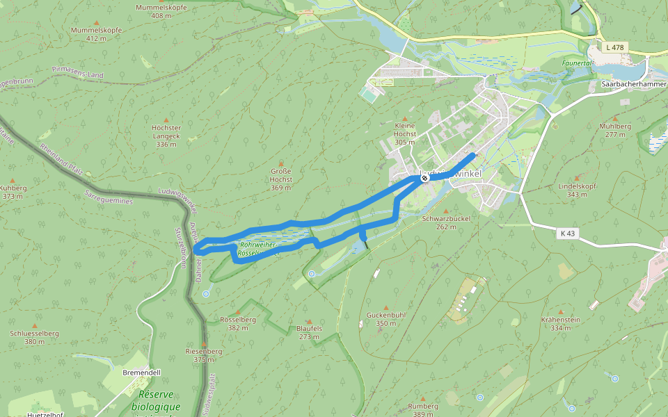
Rumberg-Steig


Length 11.3 Km
Dorfplatz (Landgrafenstraße 44, 66996 Ludwigswinkel) – Area 1 – Rumberg – Rumberg-Felsen (Ostfels, Lochfels, Wespenfels, Habichtsfels und Kastenfels) – Guckenbühl – Weiher – Rösselsquelle – Dorfplatz
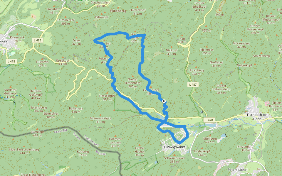
Hohe List-Tour
Length 17.0 Km
Dorfplatz (Landgrafenstraße 44, 66996 Ludwigswinkel) - Landgrafenstraße – Schöntal – Schöntalweiher - Kiosk Schöntalweiher – Bienenlehrstand – Biesenberg –Zigeunerfels –
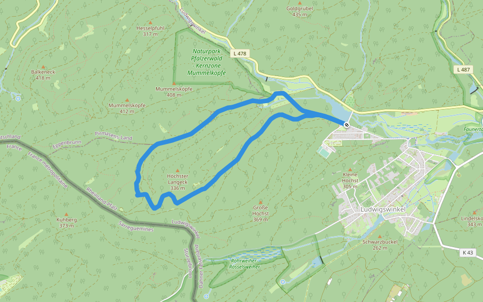
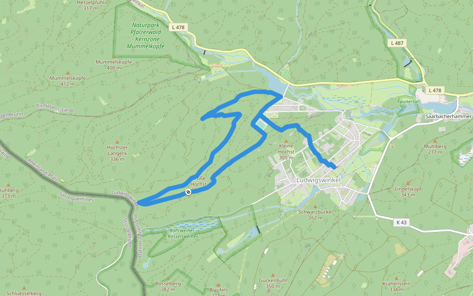
Ludwigswinkel Rundweg 7
Length 6.8 Km
Routenverlauf: Schöntalweiher - Höchster Lang-Eck - Reißlerhof
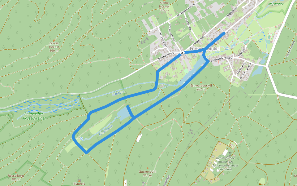
Ludwigswinkel Rundweg 5
Length 5.9 Km
Routenverlauf: Ludwigswinkel Ortsmitte Rösselsweiher Rohrbachquelle
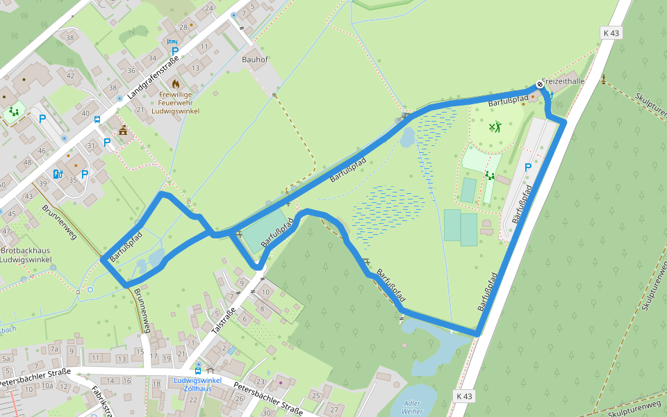
Barfußpfad Ludwigswinkel
Length 1.5 Km
barefoot walking route, foot sensation experience
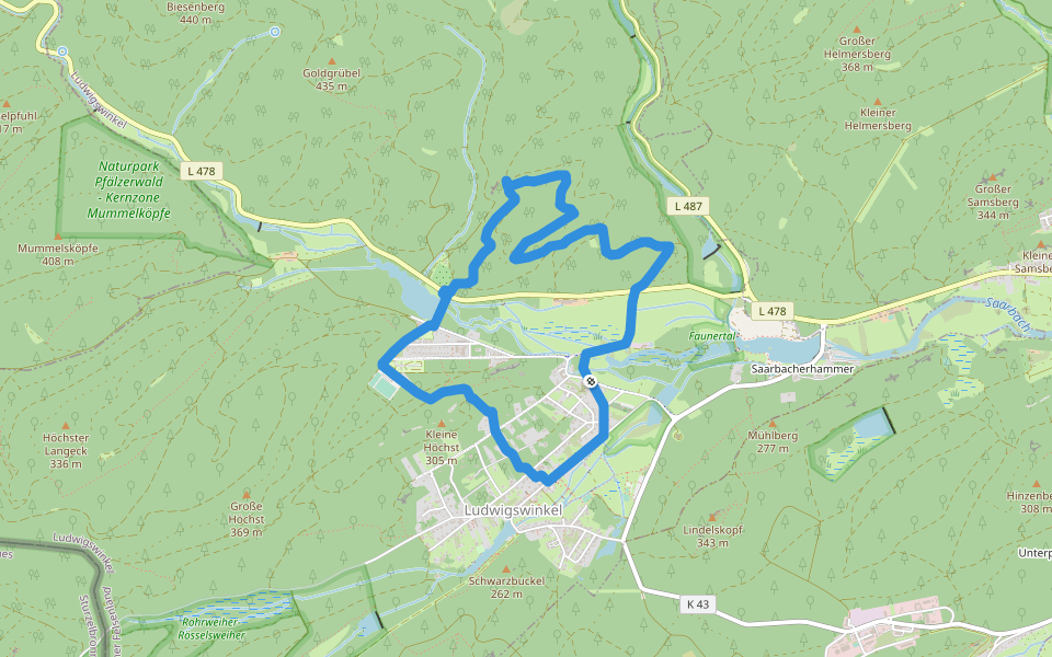
Ludwigswinkel Rundweg 2
Length 4.4 Km
Routenverlauf: Ludwigswinkel Ortsmitte Sägmühlweiher Rösselsweiher Rösselsquelle
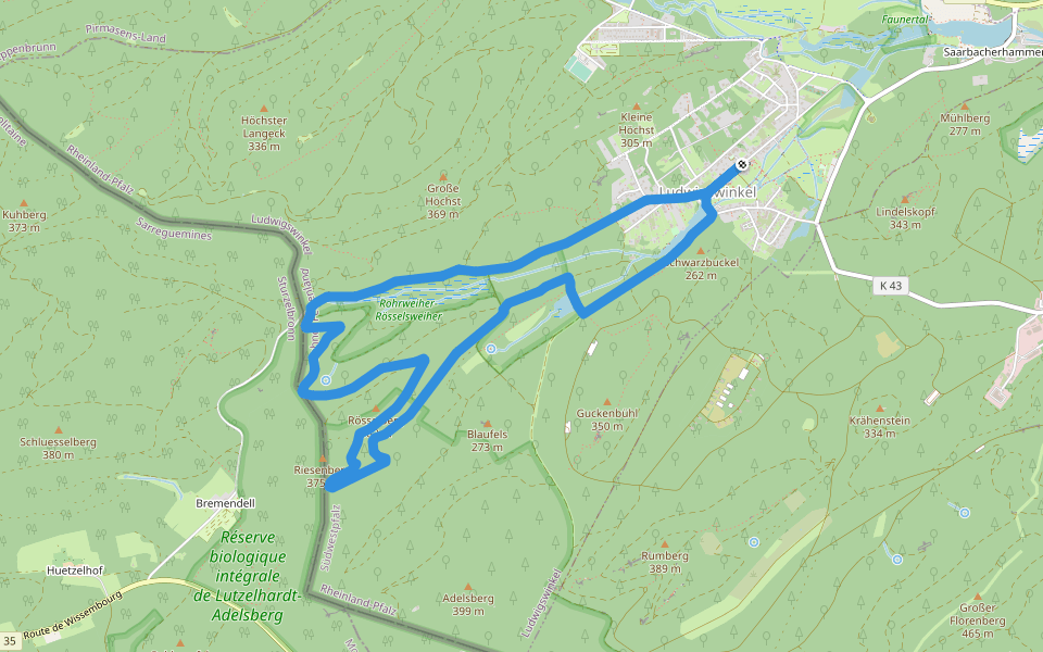
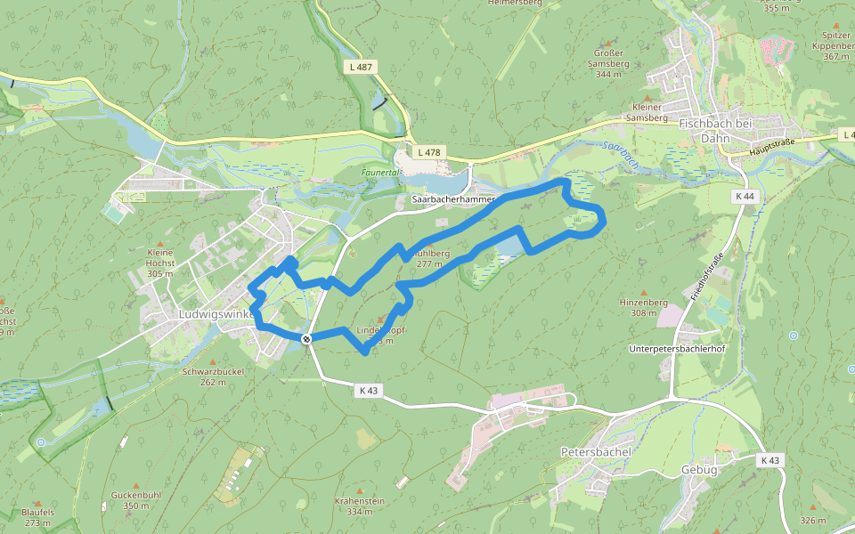
Ludwigswinkel Rundweg 4
Length 8.9 Km
Routenverlauf: Ludwigswinkel Ortsmitte Sägmühlweiher Rösselsweiher Rösselsberg Grenzübergang
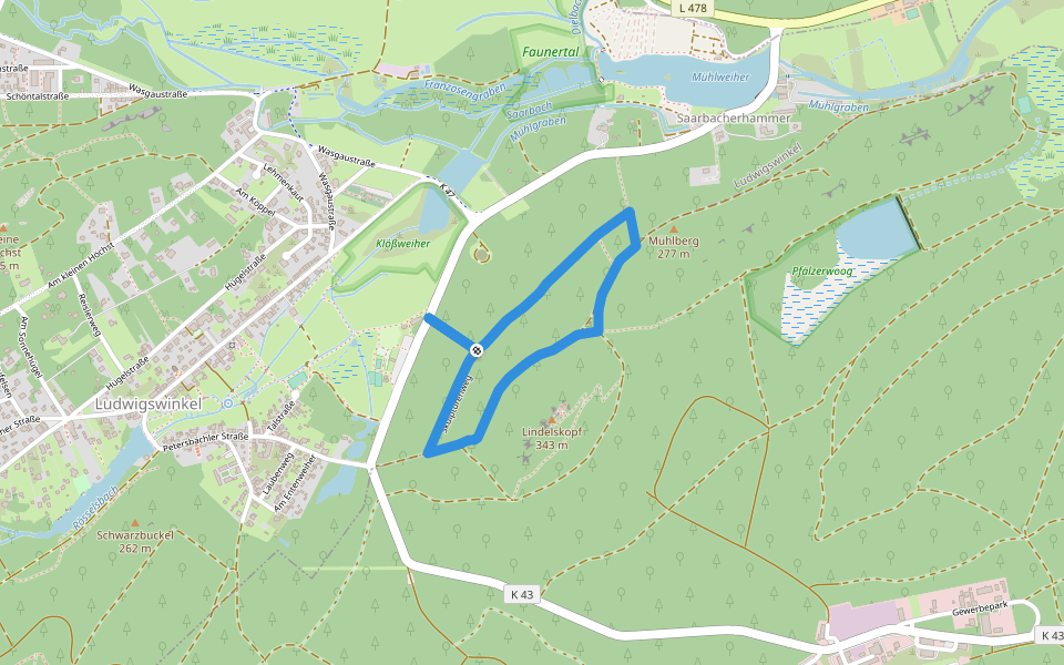
Skulpturenweg Ludwigswinkel
Length 2.2 Km
Routenverlauf: Ludwigswinkel Lindelskopf
Ludwigswinkel Rundweg 6
Length 8.8 Km
Routenverlauf: Ludwigswinkel Ortsmitte - Grosser Höchst - Schöntalweiher
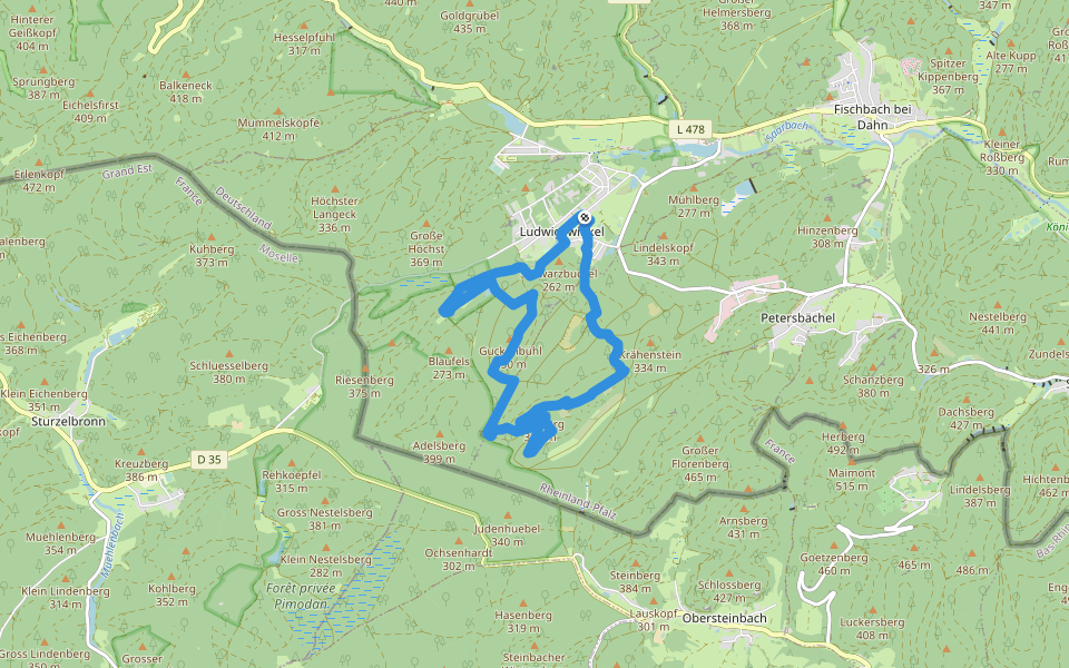
Lindelskopf-Tour
Length 7.0 Km
Dorfplatz – Rathaus - Kinderlehrgarten – Petersbächler Straße – Entenweiher - Südseite Lindelskopf mit Aussicht - Naturschutzgebiet Pfälzerwoog – Skulpturenweg – Barfußpfad – Dorfplatz
Horbachkanzel-Runde
Length 6.9 Km
Ortsmitte - Daniel-Theysohn-Haus – Schöntal – Schöntalweiher - L478 überqueren – Horbachkanzel – Höhenweg - Landstraße (L478) queren - Dickschen -Obstbaumallee - Ortsmitte


 5.0 · 1 Review


