


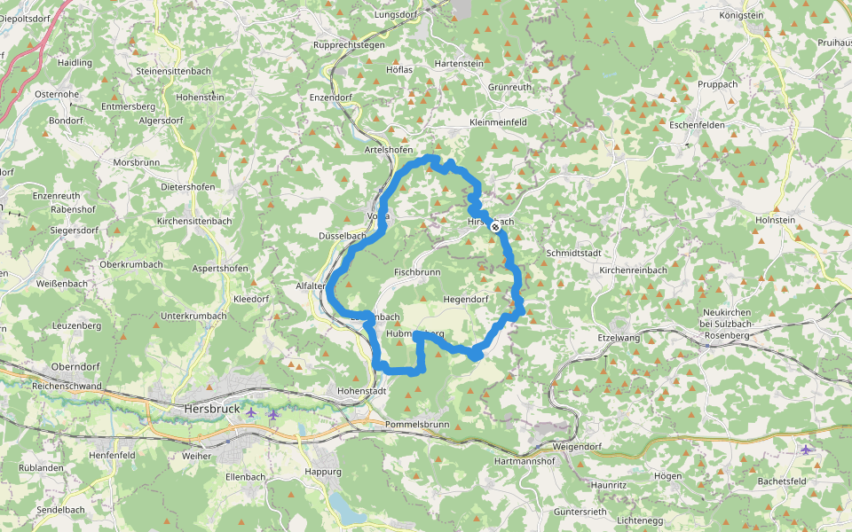
Heinrich-Scheuermann-Weg


Length 22.8 Km
[FAV 072] Rundweg um Vorra (Lkr. Nürnberger Land)
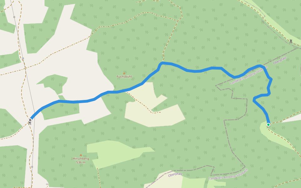
Etzelwang – Hirschbach
Length 7.6 Km
[FAV 159] Etzelwang (Lkr. Amberg-Sulzbach) – Hirschbach (Lkr. Amberg-Sulzbach)

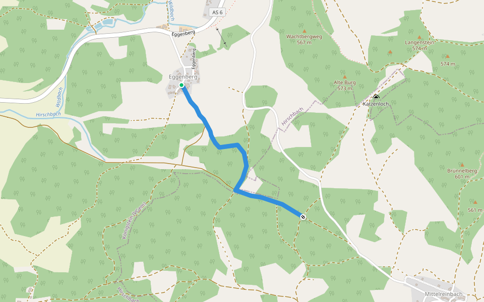
Eschenfelden Rundweg 7a
Length 1.3 Km
[LOC 30807] Abkürzer: Eggenberg – Gestübe
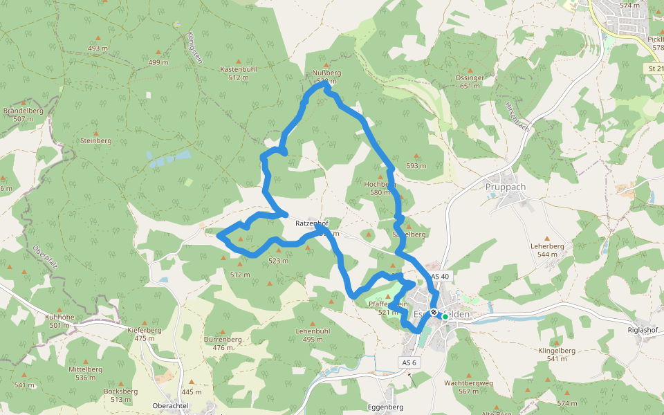
Eschenfelden Rundweg 5
Length 8.6 Km
[LOC 30805] Rundwanderweg mit Zubringer: Eschenfelden – Pfaffenstein – Ratzenhof – Karrenberg – Wolfstal – Rosengarten – Hochberg – Eschenfelden
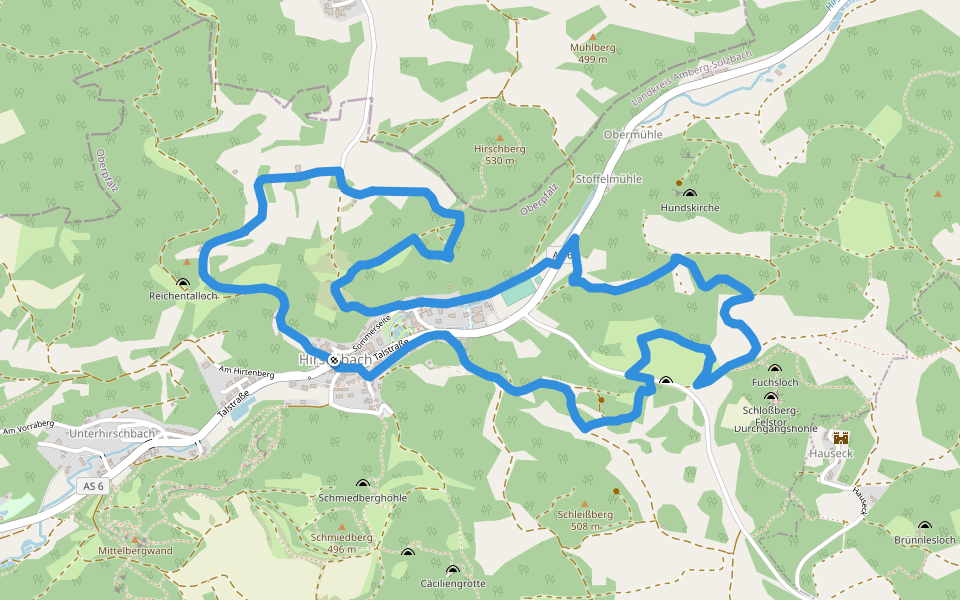
Hirschbacher Ziegenrundwanderweg
Length 6.3 Km
[LOC 30820] Rundwanderweg: Hirschbach - Ziegelhütte – Aussichtsturm – Hirschbach - Gänseck am Winterberg – Kitzenried – Lehwinkel – Ehrling – Hirschbach
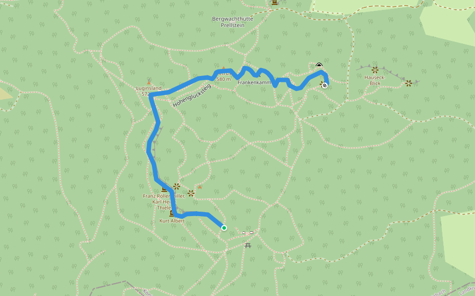
Höhenglücksteig
Length 0.7 Km
Klettersteig mit Schwierigkeit C/D
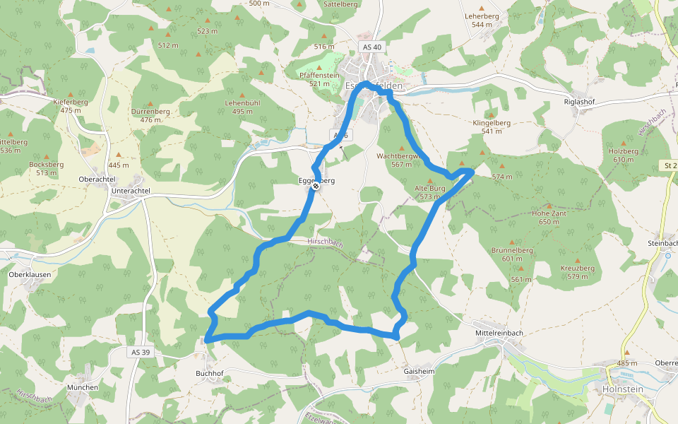
Eschenfelden Rundweg 8
Length 8.0 Km
[LOC 30808] Rundwanderweg mit Zubringer: Eschenfelden – Katzenloch – Zantberg – Kreuzbergsattel – Steinbach – Zantberg – Eschenfelden
Bruckberger Weg
Length 5.5 Km
[LOC 30821] Rundwanderweg: Hirschbach – Schleißberg – Prellstein – Mittagsfels – Noristörle – Unterhirschbach – Hirschbach

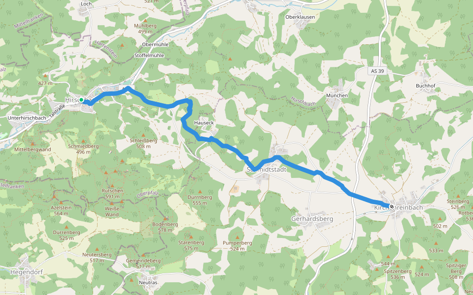
Hirschbach-Kirchenreinbach
Length 5.0 Km
[FAV 171] Hirschbach (Lkr. Amberg-Sulzbach) – Kirchenreinbach (Gde. Etzelwang, Lkr. Amberg-Sulzbach)
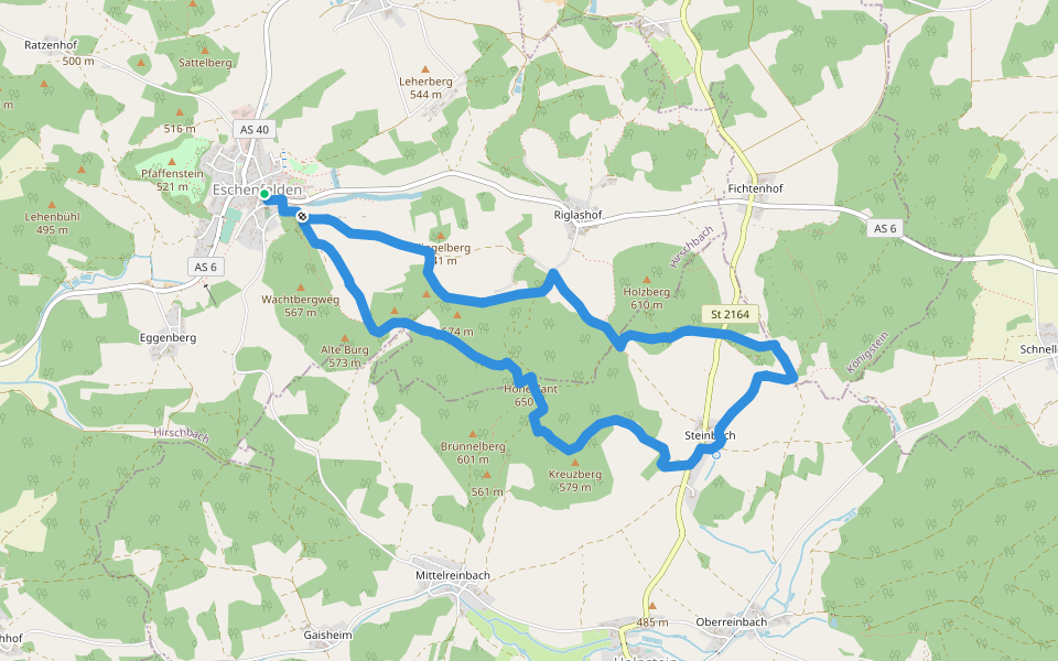
Eschenfelden Rundweg 7
Length 7.9 Km
[LOC 30807] Rundwanderweg: Eschenfelden – Eggenberg – Dachsberg – Buchhof – Gaisheimer Höhe – Gestübe – Katzenloch – Eschenfelden
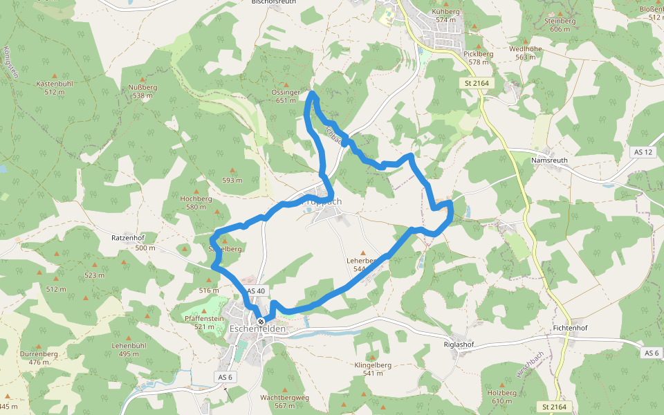
Eschenfelden Rundweg 10
Length 7.6 Km
[LOC 30810] Rundwanderweg: Eschenfelden – Sattelberg – Pruppach – Ossinger - Pfaffenberg – Wildenhof – Erdgasspeicher – Eschenfelden
Heinrich-Scheuermann-Weg-Korbmachersteig
Length 1.7 Km
[LOC41421] Zielwanderweg: Heinrich-Scheuermann-Weg-Korbmachersteig
Via Ferrata Piccoli
Length 0.0 Km
Übungsklettersteig mit geringer Höhe


 5.0 · 1 Review


