


[Č] Jaroměř (žst.) - Zvičina


Length 30.2 Km
![[Č] Jaroměř (žst.) - Zvičina walking route map in Jaromer](https://cdn.pacer.cc/route/screenshot/osm_942839.png)
[Z] Josefov - most - Josefovské louky
Length 2.9 Km
![[Z] Josefov - most - Josefovské louky walking route map in Jaromer](https://cdn.pacer.cc/route/screenshot/osm_6743529.png)
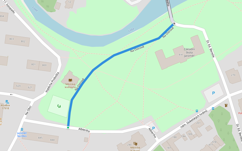
Na Ostrově
Length 0.2 Km
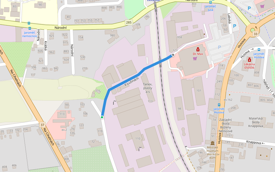
V Lužinách
Length 0.3 Km
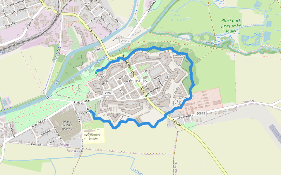
Josefovské šance
Length 3.0 Km
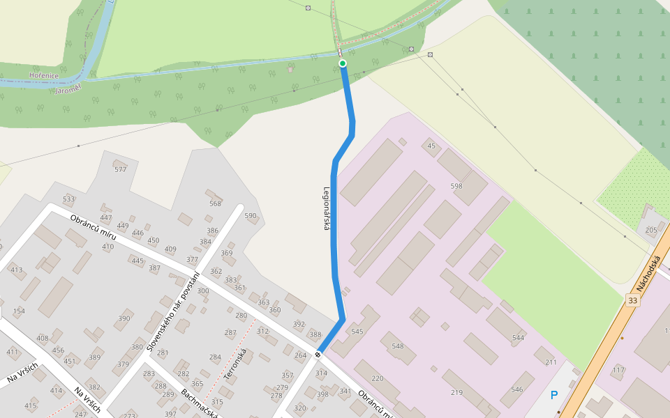
Legionářská
Length 0.3 Km

Explore the best walking trails and routes in Jaromer. Explore scenic nature walks, urban adventures, and hidden gems right in your city. Start your journey today and uncover the best walking trails & routes near you with this curated list from Pacer Walking App.
0~5 km

5~10 km
10~20 km
More than 20 km
![[Z] Adršpašské skály - placený okruh walking route map in Jaromer](https://cdn.pacer.cc/route/screenshot/osm_1243334.png)
![[Z] Adršpašské skály - placený okruh](data:image/png;base64,iVBORw0KGgoAAAANSUhEUgAAACoAAAAqCAYAAADFw8lbAAAACXBIWXMAACE4AAAhOAFFljFgAAAAAXNSR0IArs4c6QAAAARnQU1BAACxjwv8YQUAAAKKSURBVHgBzVnLUQJBEO2loLhiBpKBROAagXrgU1xWIhAjkAzUCCwvFJ+DGIGGQAZuCF6BAuy2dqhVZnd65Cm8qq2dGnbG3vde97RABEar1TqWi8AoEBjr9fpitVpdERhFAoMDjYIg+CAwAgJCJGc232VcKBSqg8EgJhCg0ovsZoyWHx1oZMYs/ykBAZM+LbsBUn4Yo2nZDZDyIwONfs4h5YdIb5PdACU/hFGb7AYo+VGBRlmfoeTfWfo82Q0Q8u/MaJ7sBgj5EYFGrmcQ8lulz2nTvs0zUxW+PZMCLP+ZZe6D99hqYGw2CRqNRo/vt3TAYEVuvhhlBkOW8JGvYzosxMx6hxl+20gvcnOgrwcU7JSDvDQ22PJovV6/Z6qvaY9gsh4Wi0VvMpls/GtNpn36Vvw4HA7vt+azFrTb7ZPlcvn8j1bY+NH2Ye7J9I++/eZHG1RH6F/61uZHG9RnfbPZ7PKmdwRElh+tz5IHgL6Ni8XiZb/fn2oXeJ31sjEfeS+0O558ghR4NyWQBuMXe3hJr+k9tZjP50euBErDl9GQQCiVSs4+Ng2vQJnNcwKB6+bfBUpARrlyePlUHai0gnyrKB6NOVlixXOVZE8V1IFy/XRKJacMJ0ltNpvVZIzY00D9/aijpEj2dsbj8SQ112XGphzwbdYB4VOmVOUpryzxH3vjq5PVULgaG22Z0jIa2iZF3tFo1M1bmLxANavHLZfLV3xznvcqj1rKkvSOZyx1l5TgF+rJGkuihZr12mQKzUCkloTJanDz8PVPWhBIsBsva8uU06NSQpjR1yRIdVvmQtoKwrTrxZ2MJiVE2rIaKkhBYoWqWEFTppyB8maxSO3blmkgiSY1V/NzzycRVW4n8alwgAAAAABJRU5ErkJggg==) 4.5 · 3 Reviews
4.5 · 3 Reviews![[Ž] Mladé Buky (kostel) - Bystřice walking route map in Jaromer](https://cdn.pacer.cc/route/screenshot/osm_3177056.png) 4.5 · 1 Review
4.5 · 1 Review![[Ž] Svoboda nad Úpou - Pod Lovčí boudou walking route map in Jaromer](https://cdn.pacer.cc/route/screenshot/osm_3158348.png) 4.0 · 1 Review
4.0 · 1 Review![[Č] Stará Lysá - Libáň walking route map in Jaromer](https://cdn.pacer.cc/route/screenshot/osm_2679624.png) 4.0 · 1 Review
4.0 · 1 Review![[Ž] Stěžery - Hrádek u Nechanic (zám., bus) walking route map in Jaromer](https://cdn.pacer.cc/route/screenshot/osm_1613211.png) 4.0 · 1 Review
4.0 · 1 Review![[Z] Svoboda nad Úpou - Václavák walking route map in Jaromer](https://cdn.pacer.cc/route/screenshot/osm_237059.png) 4.0 · 1 Review
4.0 · 1 Review![[Č] Svoboda nad Úpou - Chata Na Rozcestí walking route map in Jaromer](https://cdn.pacer.cc/route/screenshot/osm_133843.png) 4.0 · 1 Review
4.0 · 1 Review![[Z] Bohuslavice n. U - Lhota walking route map in Jaromer](https://cdn.pacer.cc/route/screenshot/osm_1137801.png) 4.0 · 1 Review
4.0 · 1 ReviewPacer is the best walking app for walking challenges and finding places to walk near me.
