


Praillon


Length 9.0 Km

Sentier des Alpages
Length 11.4 Km
Via Alpina Red R114
Length 16.3 Km
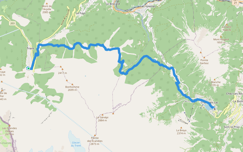
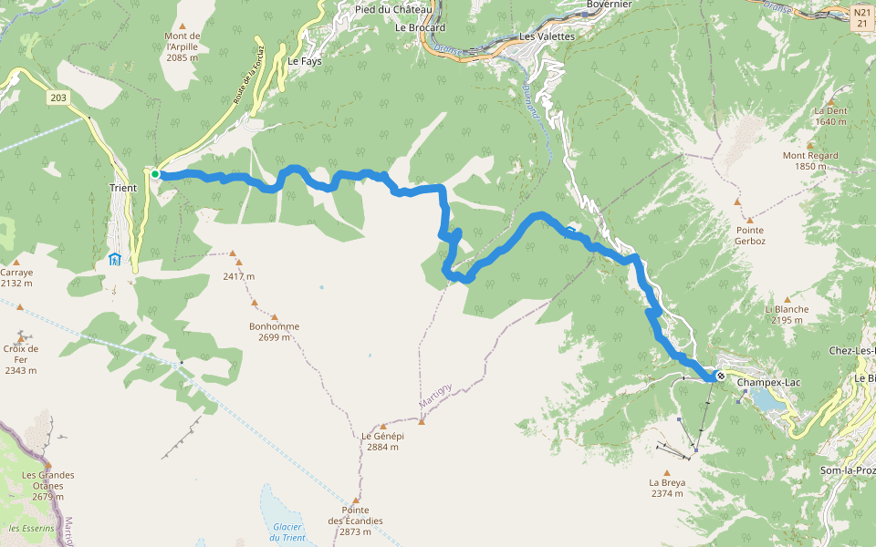
Trient - Champex
Tour Du Mont Blanc - Variante de la Fenêtre d'Arpette
Length 9.7 Km
TMB CCW Alt Stage 8.2 Chalet du Glacier – Refuge Les Grand
Length 2.3 Km
Long distance walks that circles the Mont Blanc Massif passing through parts of Switzerland, Italy and France.
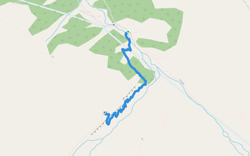
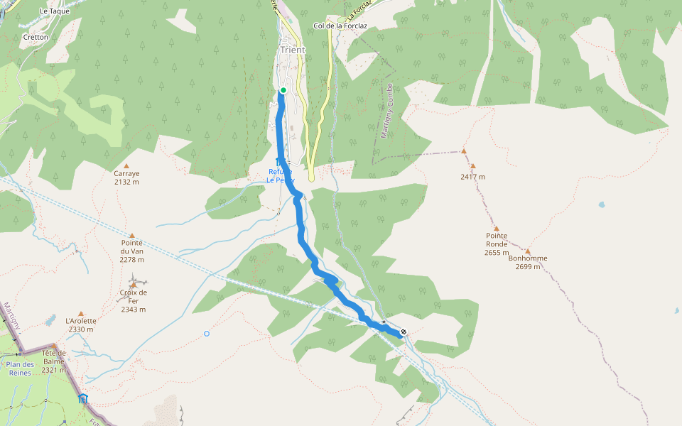
TMB CCW Alt Stage 9.1 Trient – Chalet du Glacier
Length 3.2 Km
Long distance walks that circles the Mont Blanc Massif passing through parts of Switzerland, Italy and France.

TMB CCW Alt Stage 9.2 Chalet du Glacier – Col de Balme
Length 6.1 Km
Long distance walks that circles the Mont Blanc Massif passing through parts of Switzerland, Italy and France.
WHR Alt Stage 2.3 Les Grands – Col de la Forclaz
Length 3.2 Km
Walker's Haute Route

WHR Alt Stage 3.1 Col de la Forclaz – Chalet du Glacier
Length 3.2 Km
Walker's Haute Route
TMB CCW Alt Stage 8.2 Chalet du Glacier – Col de la Forclaz
Length 3.2 Km
Long distance walks that circles the Mont Blanc Massif passing through parts of Switzerland, Italy and France.

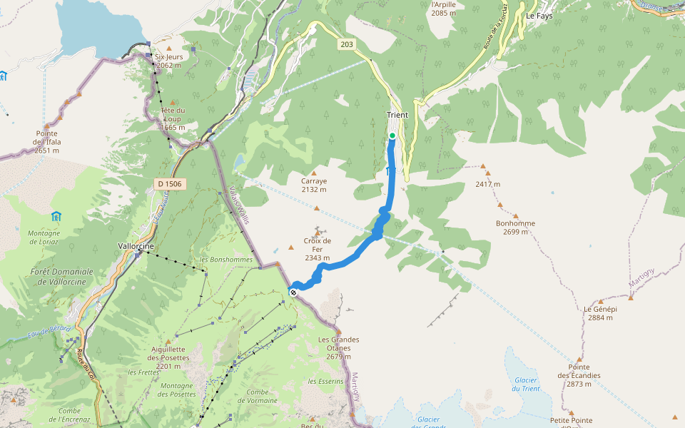
TMB CCW Alt Stage 8.2 Chalet du Glacier – Trient
Length 3.2 Km
Long distance walks that circles the Mont Blanc Massif passing through parts of Switzerland, Italy and France.

TMB CCW Stage 9.2 Trient – Col de Balme
Length 5.6 Km
Long distance walks that circles the Mont Blanc Massif passing through parts of Switzerland, Italy and France.
TMB CCW Alt Stage 9.1 Col de la Forclaz – Chalet du Glacier
Length 3.2 Km
Long distance walks that circles the Mont Blanc Massif passing through parts of Switzerland, Italy and France.

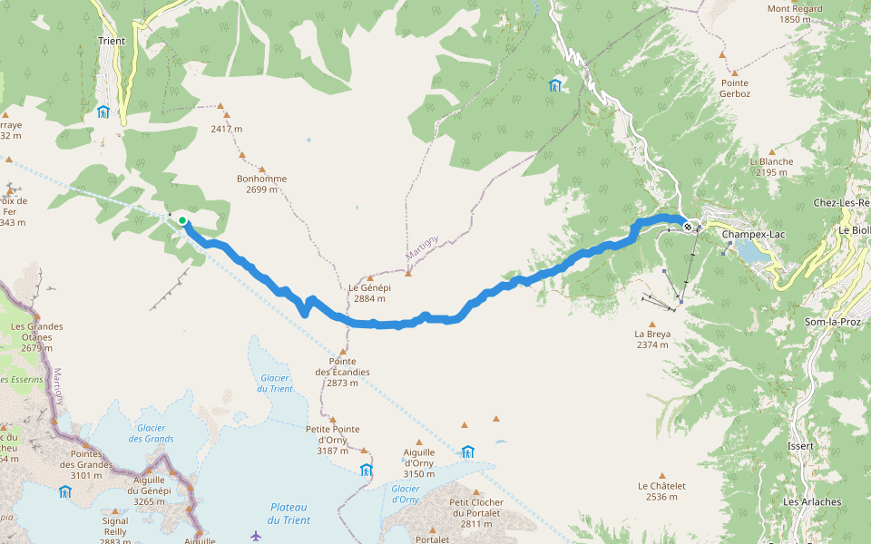
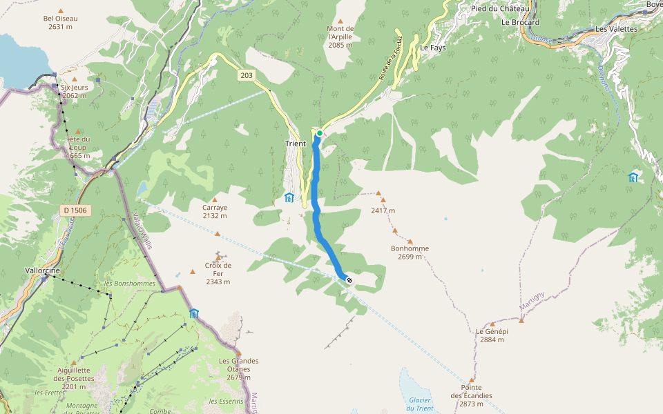
WHR Stage 3.1 Trient – Chalet du Glacier ***
Length 3.2 Km
Walker's Haute Route
WHR Alt Stage 3.2 Col de la Forclaz – Alp Bovine – Champex
Length 13.2 Km
Walker's Haute Route
Tour Du Mont Blanc - Variante des Grands
Length 8.8 Km


 4.5 · 2 Reviews


