


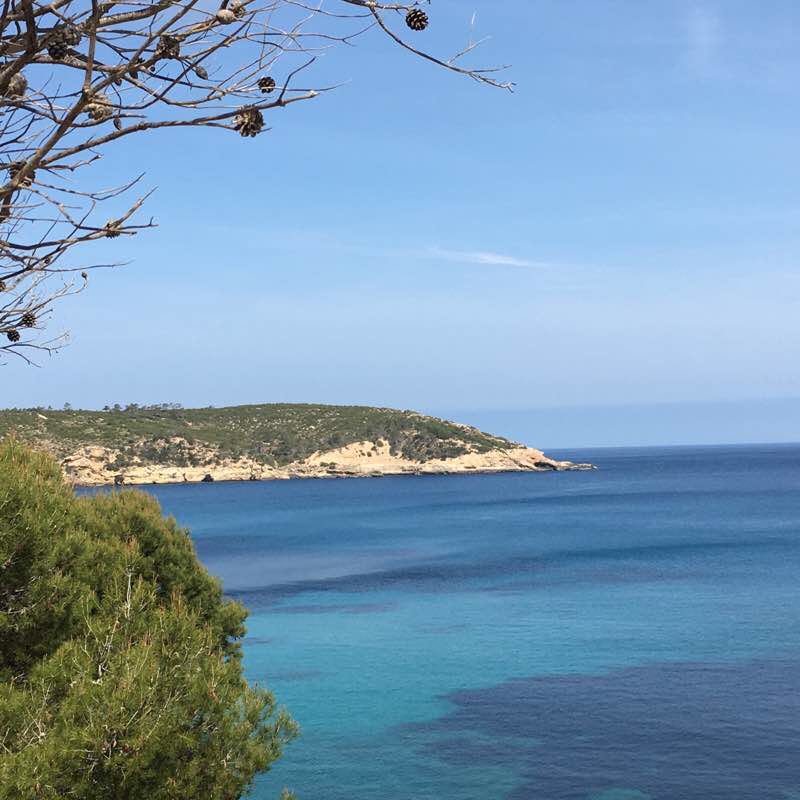
Cala Xarraca


Length 4.7 Km
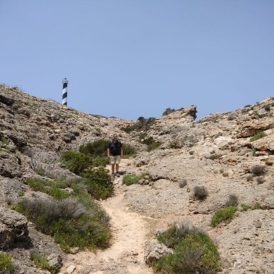
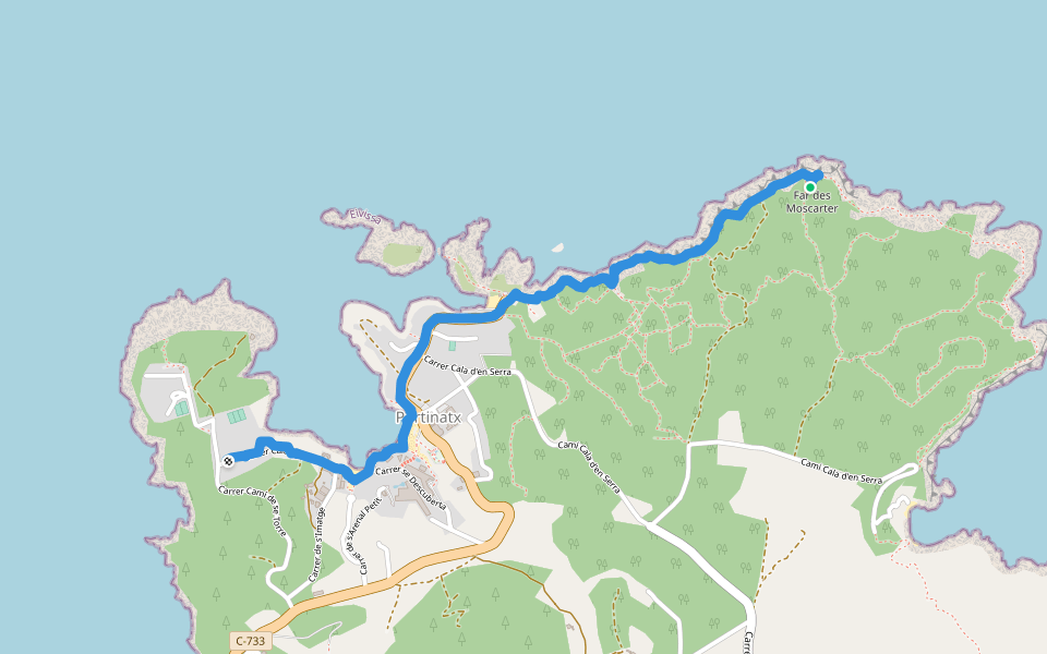
Portinax Ibiza
Length 6.6 Km
De Cala Portinax au Phare. Puis sentier côtier jusqu'à Cala d'En Serra ( marque jaune et blanche). Retour par l'ancienne route de Sant Joan à Portinax.
Environ 2 heures de marche avec quelques passages relativement difficile.
Rando from Puerto San Miguel Ibiza
Length 8.1 Km
Belle rando vers Benirras avec de très belles vues en surplomb de la mer et de la Cala Benirras.
Puis l'on part à la découverte d'une belle vallée avec de magnifiques vielles terrasses, des oliviers, des forêts de pins.
Le retour en descente vers Port Sant Miguel se fait par un ancien chemin pierreux plein de charme avec de beaux points de vue sur la campagne environnante.
Quelques informations pour effectuer la rando sans se tromper de chemin.
1) Départ de Port Sant Miguel par la route de Benirras. (Après 1 Km possibilité de visiter une belle grotte duré 1h30 env.)
puis rester sur la route de Benirras durant encore 2 Km, là en fin de virage à gauche tourner à droite il y a un poteau de signalisation ," Ruta 5" No 62 qui donne la direction.
2) Après avoir tourné à droite sur une petite route goudronnée vous gardez cette route durant 2,1Km, jusqu'à un nouveau poteau "Ruta 5" No 67 prendre à droite en épingle un chemin en terre devant une terrasse. Attention il y a un même chemin en épingle environ 400m avant mais sans poteau "Ruta"
3) Après 500m sur ce chemin de terre il y a une bifurcation prendre à gauche (en face) et garder ce chemin jusqu'à une maison avec une piscine bien visible sur la droite du chemin après 500m de la bifurcation.
4) A partir de cette maison commence une descente de 700m pour arriver à un T prendre à droite en montant puis suivre un chemin de terre durant 800m pour arriver à un T sur une route goudronnée qui descend et revient au point de départ de la rando.
Environ 2h30 de marche effective et 8 Km.

Vista Atardecer
Length 3.0 Km

 5.0 · 1 Review


