


Complexo Esportivo do Maracanã


Length 2.0 Km

Lagoa Rodrigo de Freitas
Length 7.4 Km
Contorne o coração do Rio - Lagoa Rodrigo de Freitas, um dos lugares mais bonitos pra caminhada, corrida e bike da Cidade. Vistas incríveis pra Morro Dois Irmãos, Pedra da Gávea e o Cristo Redentor

Estádio Olímpico Nilton Santos
Length 2.0 Km

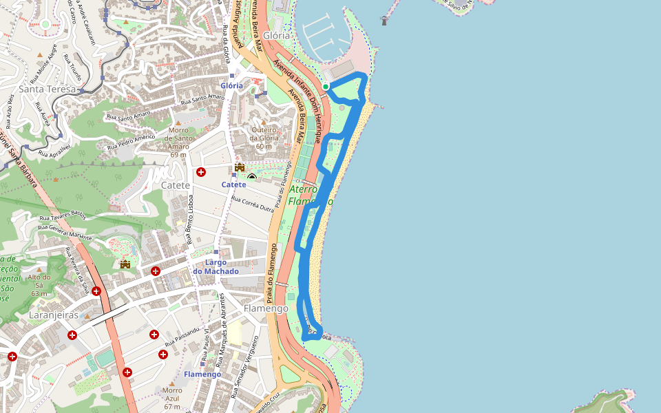
Aterro do Flamengo
Length 4.1 Km
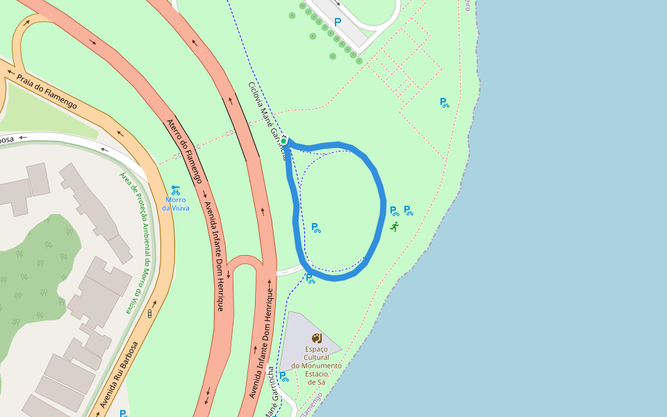
Aterro do Flamengo
Length 0.3 Km
Museu do Amanhã
Length 0.9 Km

Parque de Madureira
Length 1.7 Km

Quinta da Boa Vista
Length 1.9 Km
Um dos primeiros parques do Rio de Janeiro, quintal dos Imperadores do Brasil, o parque Quinta da Boa Vista é um lugar excelente pra caminhar, correr e se conectar com a natureza. Boas pistas, bastante sombra e com carrinhos que vendem água e também água de côco. É só ir e aproveitar .

Calçadão de Copacabana
Length 3.1 Km

Praça Santa Emiliana
Length 0.5 Km

Parque dos Patins
Length 0.8 Km

Praça Comandante Xavier de Brito
Length 0.4 Km

Power Center Linha Amarela
Length 1.1 Km

Lagoa da Tijuca
Length 3.2 Km
Parque Natural Municipal da Freguesia
Length 1.3 Km

Parque Natural Municipal da Freguesia
Length 1.1 Km

Calçadão do Leme
Length 0.9 Km

Pista Cláudio Coutinho
Length 1.4 Km

From Alah's Garden to Helm
Length 9.3 Km
Caminhada Urbana, evitando usar transporte público. Economizando passagem,ecologicamente correto e muito mais saudável. Outra opção. Ao invés de ir pela orla sem sombra ir pelas ruas de dentro dos bairros onde os prédios residenciais e comerciais proporcionam muita sombra a essa hora da manhã.
Outlining the Heart of Rio - Lagoa
Length 7.9 Km
Contorne o coração do Rio - Lagoa Rodrigo de Freitas, um dos lugares mais bonitos pra caminhada, corrida e bike da Cidade. Vistas incríveis pra Morro Dois Irmãos, Pedra da Gávea e o Cristo Redentor


 4.5 · 5 Reviews

