


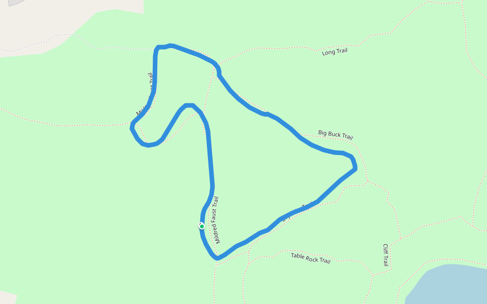
Clark Reservation State Park


Length 1.3 Km
Mildred faust
Length 3.5 Km
Clarks reservation
Length 6.5 Km
Clark Reservation
Length 3.4 Km
Great place! A variety of diverse trails, cool fossils, rock formations, and plants.
Table rock paths, rugged terrain, earthy woodland trails, or gravel paths, there’s something for everyone.
Some may consider the cliff trail dangerous at a couple points- be very careful with small children! Lake trail puts you at a meromictic lake’s edge if the water is lower, or if higher, you may not be able to get through the trail without boots. A steep 100+ step stone staircase will get your heart rate up! Mildred Faust woodland trail has a small waterfall and bridge through a lovely and peaceful wooded section. Playground near parking lot. Lots of dog walkers and families.
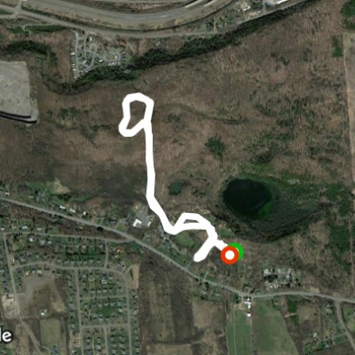
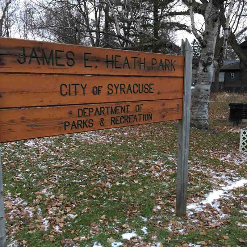
Heath Park-Hidden gem in Syracuse’s “Valley” area.
Length 2.2 Km
I have driven past this park for over a decade and never took a second look...
Until Pacer challenged us to post routes in parks. I found something special in the James E. Heath Park, also locally known as Conifer Park.
Heath Park is located in The Valley at 5559 South Salina St between Cleary Middle School and Green Hills Grocery. Parking is available at the small pull-off on Conifer Drive. There is another park entrance at Lynn Circle.
Heath Park has been called “the forest in the city” as it is the largest wooded park in the city of Syracuse. Some say it is a taste of the Adirondacks right here in Syracuse.
The 33 acre park was once an experimental station of SUNY Environmental College of Science and Forestry. ESF donated the land to the city, giving the neighbors in the area green space to enjoy.
At South Salina St there is signage to read about the park and view a trail map, a couple of park benches to sit and watch the traffic roll by, and a large pile of boulders with a plaque commemorating the Iroquois Trail.
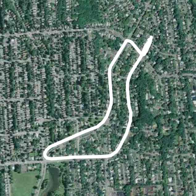
Behind that is a large open grassy area ideal for kids to run around and “be free”, play games etc. To the right, take the path which leads to the through a patch of woods to the trail up the hillside. This path borders the backyards of the neighbors on Richfield Ave.
You will cross a maroon painted bridge. As you look up and down Cold Creek, all the bridges are painted maroon. A foot path connects the two neighboring streets, indicating heavy usage by the neighbors.
Just over the bridge is a Community Garden.
The trail continues into more woods, then ascends up the steep mountain curving around to give a beautiful view of massive bedrock and glacial lands. The higher you climb the more beautiful it gets. You will forget you are in a city.
Towards the top a tree has fallen across the paved road/path. This happens to also be an intersection. You may go left or right, I did not go any further up the trail as it seemed Interstate 81 was just ahead, which is where the trail ends. I could see some traffic on the highway. I chose to go right, following the roll-y poll-y path, watching squirrels run about. There is posted land on the right so stay on the path. If I had taken a left it would have taken me to Lynn Circle, the other park entrance.
It was getting dark so when I came to the southern edge of the park property, I turned around and came back, instead of turning left and heading up to the highway and looping around and back down to the intersection where the fallen tree was.
I ran upon a couple of friendly dog walkers who had stopped to chat- very neighborly.
The lower, flat part of the park is suitable for strollers on the once-paved pathway. But as I started the steep climb, it was too steep to push a stroller. There was still pavement all the way up to the intersection. Once I turned right at the top, the path became natural earth.
I felt a sense of community at Heath Park. I felt safe to walk alone, even at dusk. The steep incline had me huffing and puffing, a great cardio workout. The school Cross Country Coach recommended this park to me, and I give it two thumbs up. 👍🏽 👍🏽
Broad-Meadowbrook
Length 2.2 Km
Big Buck Trail
Length 0.5 Km
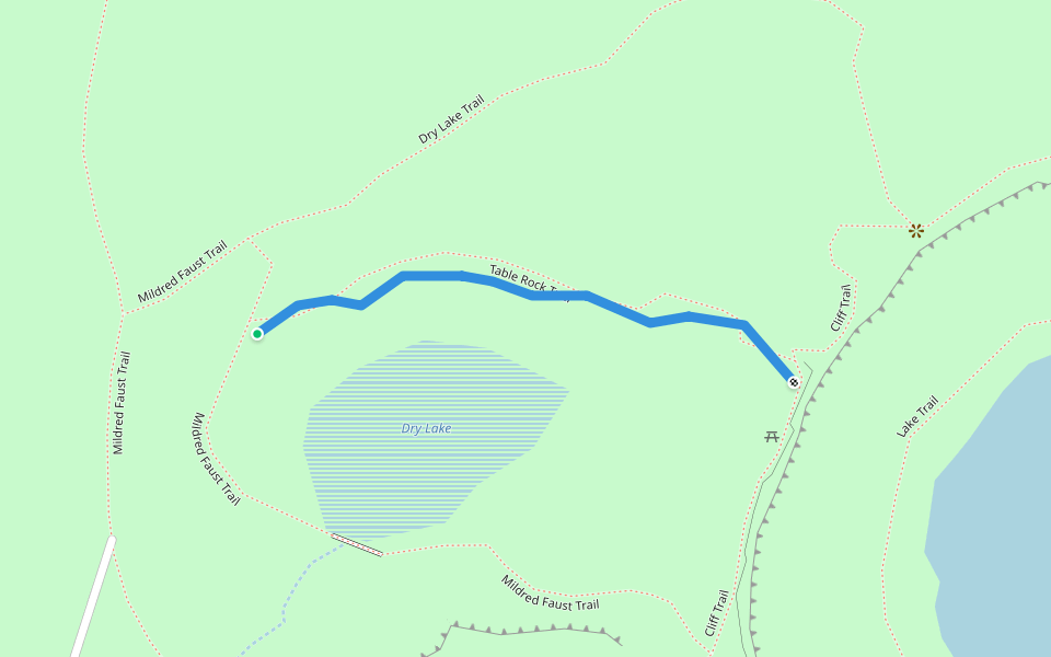
Dry Lake Trail
Length 0.3 Km
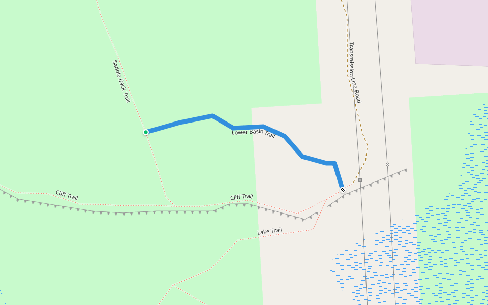
Lower Basin Trail
Length 0.2 Km
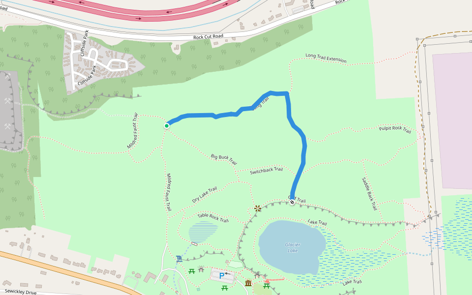
Long Trail
Length 0.9 Km
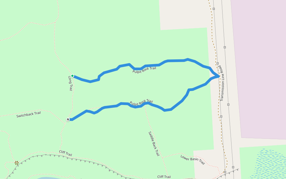
Pulpit Rock Trail
Length 1.0 Km
Saddle Back Trail
Length 0.2 Km
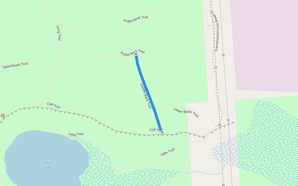
Table Rock Trail
Length 0.2 Km
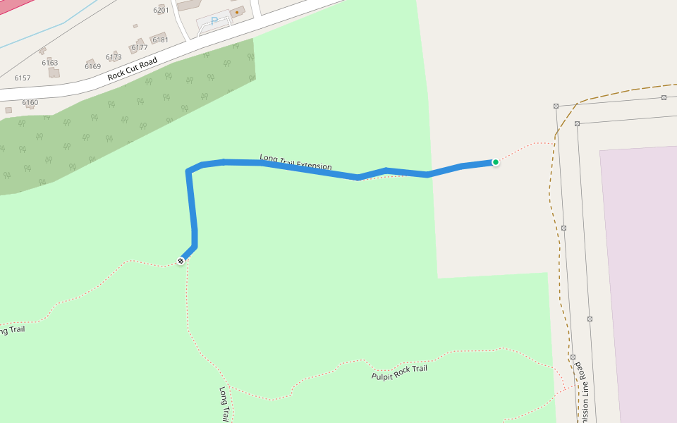
Long Trail Extension
Length 0.5 Km


 5.0 · 1 Review


