


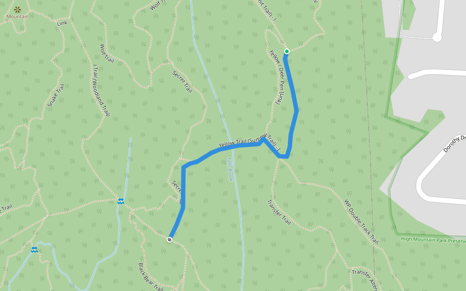
Yellow / Deer Pen [Link]


Length 0.3 Km
![Yellow / Deer Pen [Link] walking route map in North Haledon](https://cdn.pacer.cc/route/screenshot/osm_way_514056604.png)
Yellow / Service Road [Link]
Length 0.4 Km
![Yellow / Service Road [Link] walking route map in North Haledon](https://cdn.pacer.cc/route/screenshot/osm_way_506142609.png)
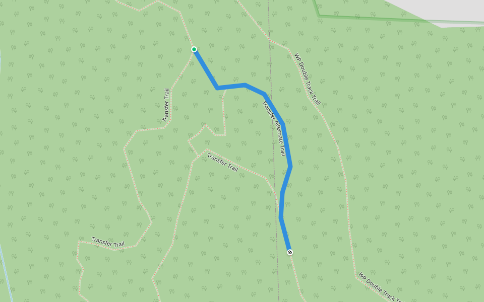
Transfer Alternate Trail
Length 0.2 Km
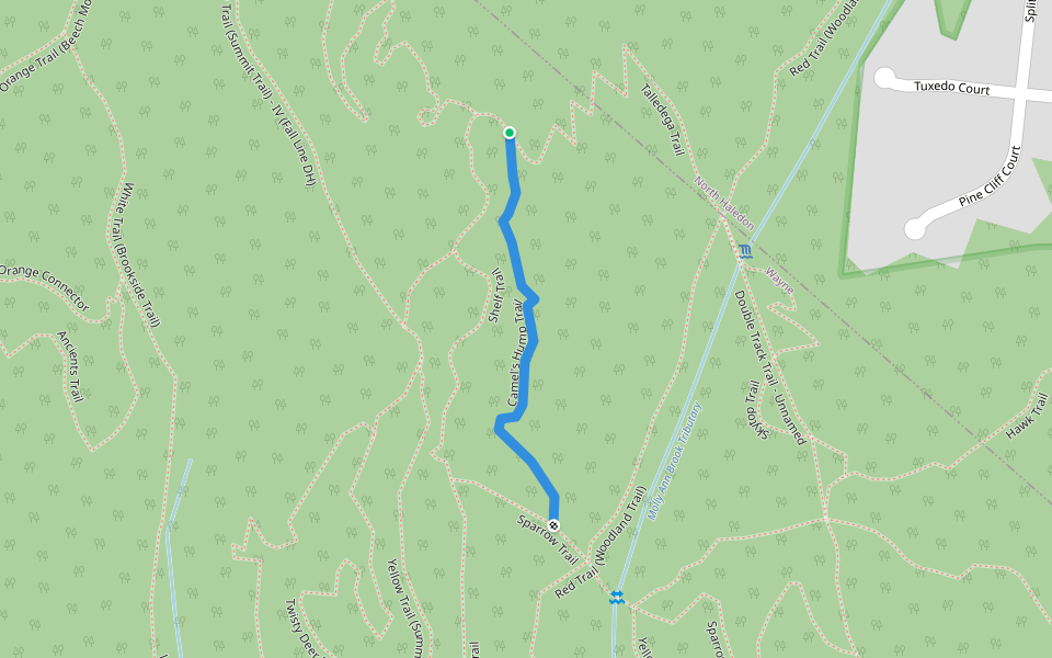
Camel's Hump Trail
Length 0.4 Km
Transfer / Deer Pen [Link]
Length 0.2 Km
![Transfer / Deer Pen [Link] walking route map in North Haledon](https://cdn.pacer.cc/route/screenshot/osm_way_800550526.png)
WP Double Track / Vine Street [Link]
Length 0.3 Km
![WP Double Track / Vine Street [Link] walking route map in North Haledon](https://cdn.pacer.cc/route/screenshot/osm_way_313285321.png)
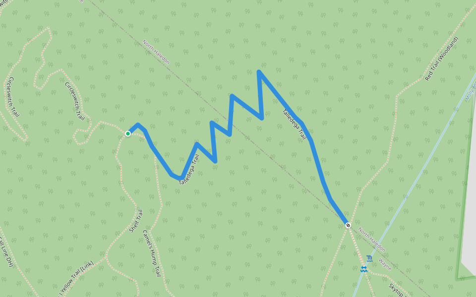
Talledega Trail
Length 0.5 Km
Yellow Trail (Summit Trail) - I
Length 0.6 Km
H's Way Trail
Length 0.5 Km
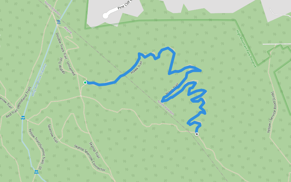
Hawk Trail
Length 1.2 Km
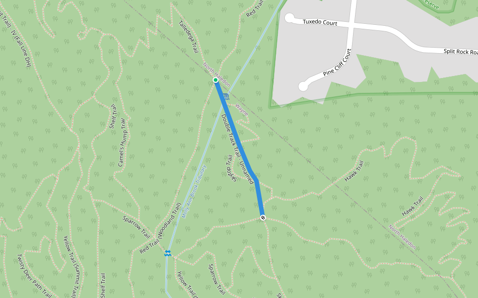
Double Track Trail - Unnamed
Length 0.3 Km
Skytop / Glen Place [Link]
Length 0.2 Km
![Skytop / Glen Place [Link] walking route map in North Haledon](https://cdn.pacer.cc/route/screenshot/osm_way_794999852.png)
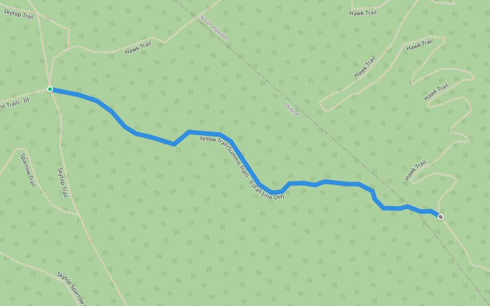
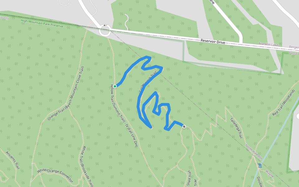
Yellow Trail (Summit Trail) - II (Fall Line DH)
Length 0.4 Km
Circleswitch Trail
Length 0.8 Km
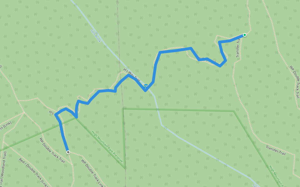
Transfer Trail
Length 1.6 Km

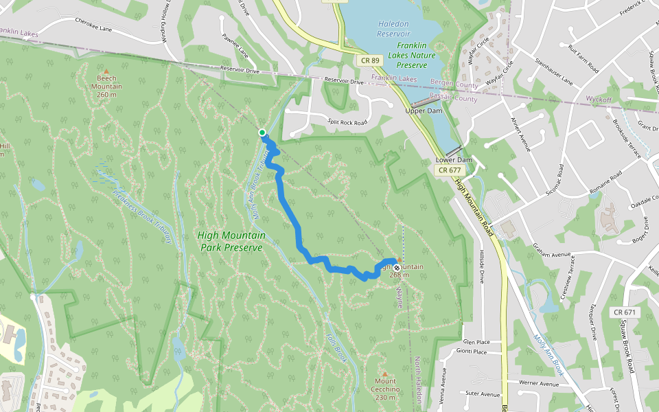
Skytop Trail
Length 1.5 Km
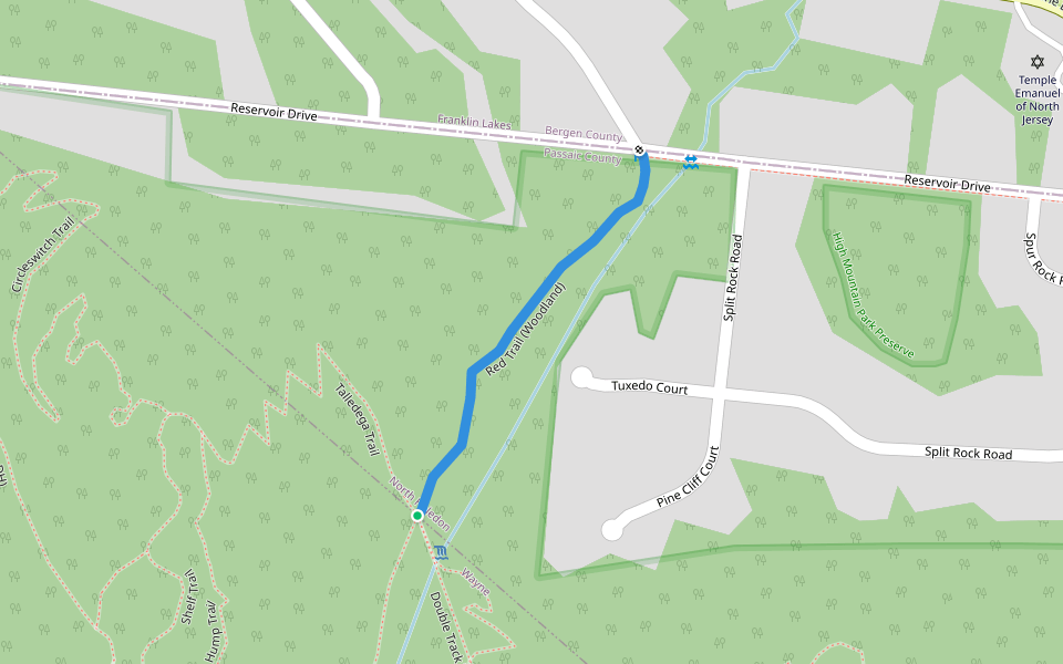
Red Trail (Woodland)
Length 0.4 Km


 5.0 · 1 Review


