Pacer Walking App
The #1 Walking App
4.8
(1643K)
Open in App
Walking App
Near Me
Clubs
Challenges
Medals
For Workplaces
© Mapbox
© OpenStreetMap
Improve this map
© Mapbox
© OpenStreetMap
Improve this map
Routes
State of Paraná
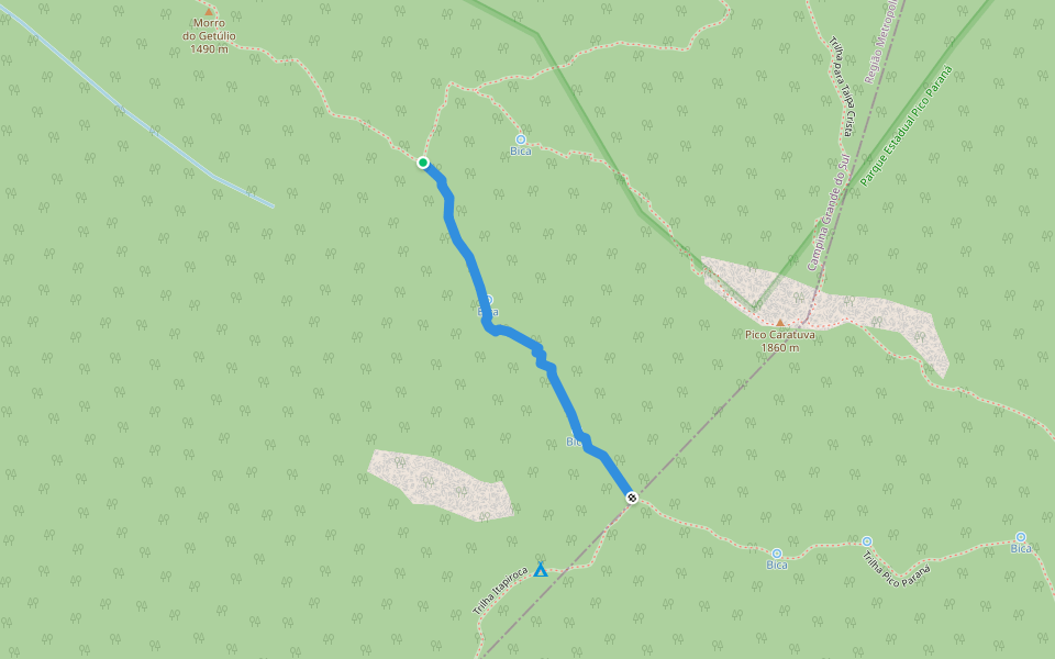
Pico Paraná and Itapiroca Trail
State of Paraná
State of Paraná
Pico Paraná and Itapiroca Trail
1
reviews
Length
0.5 mi
Elev. Gain
45.9 ft
Est. Steps
1000
Pico Paraná and Itapiroca Trail Introduction
Pico Paraná and Itapiroca Trail is a 0.5 mile (1,000-step) route located near State of Paraná. This route has an elevation gain of about 45.9 ft and is rated as easy. Find the best walking trails near you in Pacer App.
Open in App for Details
Map of Pico Paraná and Itapiroca Trail
© Mapbox © OpenStreetMap
View Full Map
View Full Map
Last updated: May 1, 2025
Route Details
Length
0.5 mi
Elev. Gain
45.9 ft
Est. Steps
1000
Recommended Routes Near Pico Paraná and Itapiroca Trail
State of Paraná
Caratuva Trail
Length 0.8 mi
· Elev 1020.1 ft
State of Paraná
Trail from Baixo to Taipabuçu
Length 0.7 mi
· Elev 469 ft
Paraná
Pico Paraná Trail
Length 1.9 mi
· Elev 580.6 ft
State of Paraná
Itapiroca Trail
Length 0.3 mi
Paraná
Trail to Taipa Crista
Length 0.7 mi
· Elev 177.1 ft
Paraná
Caratuva Trail - Camp. TO 1
Length 0.6 mi
· Elev 72.2 ft
Pacer Walking App
Pacer is the
best walking app
for walking challenges and finding
places to walk near me
.
Open in App for Details
Cancel
Yes
Pacer Walking App
The #1 Walking App
4.8
(1643K)
Open in App
Walking App
Near Me
Walking Clubs
Walking Challenges
Medals
For Workplaces