


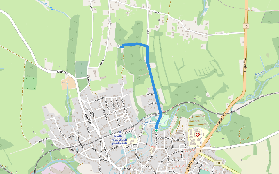
[Ž] Harta (horní rozc.)


Length 0.1 Km
![[Ž] Harta (horní rozc.) walking route map in Frýdlant](https://cdn.pacer.cc/route/screenshot/osm_2581125.png)
Městský okruh - modrá (not connected)
Length 1.2 Km
Městský okruh - modrá
Length 1.0 Km

Explore the best walking trails and routes in Frýdlant. Explore scenic nature walks, urban adventures, and hidden gems right in your city. Start your journey today and uncover the best walking trails & routes near you with this curated list from Pacer Walking App.
0~5 km

5~10 km
10~20 km
More than 20 km
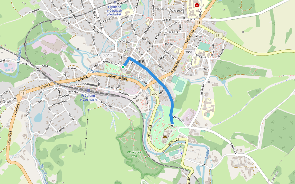
![[Ž] odbočka k Zámecké vyhlídce walking route map in Frýdlant](https://cdn.pacer.cc/route/screenshot/osm_11548303.png)
![[Ž] odbočka k Zámecké vyhlídce](data:image/png;base64,iVBORw0KGgoAAAANSUhEUgAAACoAAAAqCAYAAADFw8lbAAAACXBIWXMAACE4AAAhOAFFljFgAAAAAXNSR0IArs4c6QAAAARnQU1BAACxjwv8YQUAAAKKSURBVHgBzVnLUQJBEO2loLhiBpKBROAagXrgU1xWIhAjkAzUCCwvFJ+DGIGGQAZuCF6BAuy2dqhVZnd65Cm8qq2dGnbG3vde97RABEar1TqWi8AoEBjr9fpitVpdERhFAoMDjYIg+CAwAgJCJGc232VcKBSqg8EgJhCg0ovsZoyWHx1oZMYs/ykBAZM+LbsBUn4Yo2nZDZDyIwONfs4h5YdIb5PdACU/hFGb7AYo+VGBRlmfoeTfWfo82Q0Q8u/MaJ7sBgj5EYFGrmcQ8lulz2nTvs0zUxW+PZMCLP+ZZe6D99hqYGw2CRqNRo/vt3TAYEVuvhhlBkOW8JGvYzosxMx6hxl+20gvcnOgrwcU7JSDvDQ22PJovV6/Z6qvaY9gsh4Wi0VvMpls/GtNpn36Vvw4HA7vt+azFrTb7ZPlcvn8j1bY+NH2Ye7J9I++/eZHG1RH6F/61uZHG9RnfbPZ7PKmdwRElh+tz5IHgL6Ni8XiZb/fn2oXeJ31sjEfeS+0O558ghR4NyWQBuMXe3hJr+k9tZjP50euBErDl9GQQCiVSs4+Ng2vQJnNcwKB6+bfBUpARrlyePlUHai0gnyrKB6NOVlixXOVZE8V1IFy/XRKJacMJ0ltNpvVZIzY00D9/aijpEj2dsbj8SQ112XGphzwbdYB4VOmVOUpryzxH3vjq5PVULgaG22Z0jIa2iZF3tFo1M1bmLxANavHLZfLV3xznvcqj1rKkvSOZyx1l5TgF+rJGkuihZr12mQKzUCkloTJanDz8PVPWhBIsBsva8uU06NSQpjR1yRIdVvmQtoKwrTrxZ2MJiVE2rIaKkhBYoWqWEFTppyB8maxSO3blmkgiSY1V/NzzycRVW4n8alwgAAAAABJRU5ErkJggg==) 4.5 · 2 Reviews
4.5 · 2 Reviews![[Č] vrchol Ještěd walking route map in Frýdlant](https://cdn.pacer.cc/route/screenshot/osm_4263500.png) 4.5 · 1 Review
4.5 · 1 Review 4.5 · 2 Reviews
 4.0 · 1 Review
 4.0 · 1 Review
![[Z] Vysoké nad Jizerou - Navarov walking route map in Frýdlant](https://cdn.pacer.cc/route/screenshot/osm_4146633.png) 4.0 · 1 Review
4.0 · 1 Review![[Č] Jablonné v Podještědí - Nový Bor walking route map in Frýdlant](https://cdn.pacer.cc/route/screenshot/osm_1174597.png) 4.0 · 1 Review
4.0 · 1 Review 4.0 · 1 Review
Pacer is the best walking app for walking step challenges and finding places to walk near me.
