Radhošť - hřeben (rozc.)


Length 6.5 Km

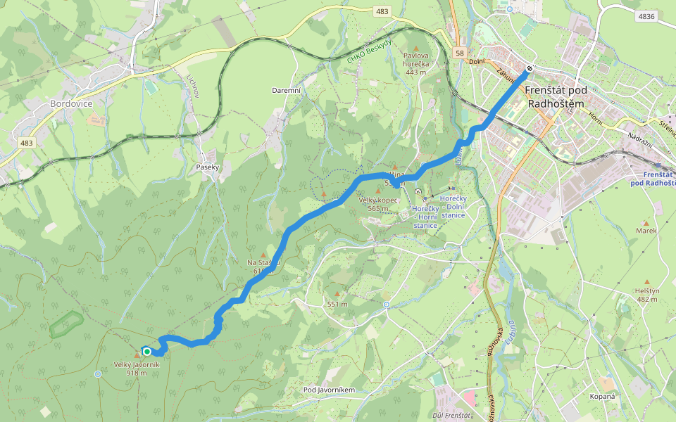
[M] Frenštát p.R. - Pustevny
Length 20.7 Km
![[M] Frenštát p.R. - Pustevny walking route map in Trojanovice](https://cdn.pacer.cc/route/screenshot/osm_392771.png)
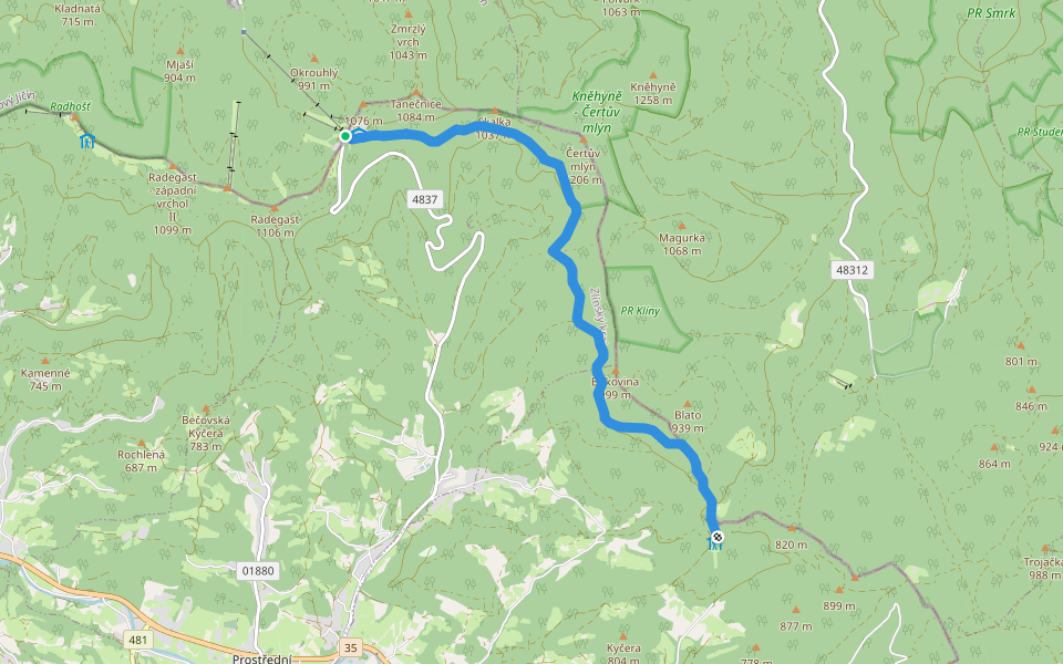
[Č] Pustevny - Visalaje
Length 42.2 Km
![[Č] Pustevny - Visalaje walking route map in Trojanovice](https://cdn.pacer.cc/route/screenshot/osm_3003912.png)
[M] Velký Javorník - Padolí
Length 2.2 Km
![[M] Velký Javorník - Padolí walking route map in Trojanovice](https://cdn.pacer.cc/route/screenshot/osm_2282976.png)
NS Frenštát p. R. - Javorník
Length 5.1 Km
Naučná stezka Čertův mlýn
Length 8.0 Km

Explore the best walking trails and routes in Trojanovice. Explore scenic nature walks, urban adventures, and hidden gems right in your city. Start your journey today and uncover the best walking trails & routes near you with this curated list from Pacer Walking App.
0~5 km

5~10 km
10~20 km
More than 20 km
Pacer is the best walking app for walking step challenges and finding places to walk near me.

 4.5 · 2 Reviews
![[M] Lysá Hora - Butořanka walking route map in Trojanovice](https://cdn.pacer.cc/route/screenshot/u2v1_20200401_1.png)